There is a town in western Kenya whose official name exists because of a typing error. In January 1912, when a gazette notice was published giving the young settlement on the Uasin Gishu plateau its formal name, a clerk misspelled Eldaret as Eldoret. Nobody corrected it. The name stuck. And in that small act of bureaucratic carelessness, Kenya’s fourth largest city was christened.
But the story of how Eldoret came to be is far stranger and more interesting than a typo. It is the story of a plateau that passed through the hands of at least four distinct peoples before the British arrived. It is the story of Boer refugees who trekked north from South Africa to escape one empire, only to help build another. It is the story of the Nandi — one of the most formidable peoples in East African history — who were systematically stripped of their ancestral land to make room for wheat farms and settler bungalows. And it is the story of how a city built on dispossession produced, against all expectation, the greatest concentration of long-distance runners the world has ever seen.
Before the Settlers: The People of the Uasin Gishu Plateau
The Uasin Gishu plateau — the great rolling highland that stretches west of the Rift Valley at an altitude of roughly 2,000 metres — was not empty when the first settlers arrived in 1903. It had been continuously inhabited for centuries, and the peoples who lived on it had shaped its landscape, economy, and political geography in ways that the settlers either did not see or chose to ignore.
The Sirikwa
The earliest known inhabitants of the plateau were the Sirikwa, a pastoral Iron Age people who thrived here from approximately the 12th to the 15th centuries. The Sirikwa are something of a mystery in Kenyan history — well-documented in archaeology but almost invisible in written records. They are best known for the distinctive circular cattle enclosures they built, sunk slightly below ground level, which survive as earthwork depressions across the plateau and on the slopes of the Cherangani Hills. These so-called “Sirikwa holes” puzzled early European settlers, who could not explain them, and were only identified as cattle enclosures through later archaeological investigation.
The Sirikwa were advanced pastoralists who worked iron, kept large herds, and organised their society around cattle. By the 16th or 17th century, they appear to have been absorbed or displaced — partly by Maasai expansion from the south and east, partly through assimilation into Kalenjin communities. Their descendants are believed to be present in multiple modern communities, including the Nandi, Kipsigis, and Tugen, who carry traces of Sirikwa culture in oral tradition and material practice.
The Uasin Gishu Maasai
After the Sirikwa came the Uasin Gishu Maasai — the westernmost extension of Maasai territorial expansion, who occupied the plateau for roughly two centuries. They named it: Uasin Gishu is a Maasai name, and the plateau’s characteristic open grassland was ideal for the pastoral economy they brought with them. At their height, the Uasin Gishu Maasai were a substantial group with large herds and significant military capacity.
But as the Iloikop Wars tore through the Maasai world in the middle of the 19th century, the Uasin Gishu section was among the first to be broken. Attacked by a coalition of pastoral Maasai sections from the south, their herds taken and their population scattered, the Uasin Gishu Maasai effectively ceased to exist as a coherent territorial group by the 1870s. Their defeat created a vacuum — and it was the Nandi who filled it.
The Nandi
The Nandi are a Kalenjin people whose ancestral territory centred on the forested hills west of the Rift Valley — the Nandi Hills, which still bear their name. For generations they had lived on the margins of Maasai territory, adapting to a world in which the plains below were controlled by a more powerful neighbour. When the Uasin Gishu Maasai collapsed, the Nandi expanded onto the plateau they had previously been unable to occupy.
By the time the first British surveyors arrived in the 1890s, the Nandi were the dominant people on the Uasin Gishu plateau — farming its fertile volcanic soil, grazing their cattle on its grasslands, and organising their society through the age-set system common to Kalenjin peoples. Their spiritual and military leader, the orkoiyot, coordinated resistance to outside threats. It was the Nandi, not the Maasai, who would become the central obstacle to British control of the plateau — and it was the Nandi who would pay the heaviest price for resisting it.
The Boers: Kenya’s Forgotten Settlers
The story of how Eldoret was founded is unlike any other Kenyan town history, because its founders were not British. They were South African Boers — Afrikaans-speaking farmers of Dutch descent who had lost the Anglo-Boer War of 1899–1902 and were looking for somewhere to start over.
The British victory in the Boer War had left many Afrikaner families landless, impoverished, and deeply hostile to British authority. When the British colonial administration in East Africa began advertising cheap land in the Kenya highlands in the early 1900s — partly to populate a territory that the Uganda Railway had made accessible but that few Europeans wanted to settle — some Boer families saw an opportunity. The land was cheap, the climate was said to resemble the South African highveld, and it was far enough from Pretoria to make a fresh start possible.
The first Boers arrived on the Uasin Gishu plateau as early as 1902 and 1903, when the Van Breda brothers — Bon, Dirk and Piet — rode up from Nakuru to survey the land. What they found confirmed the reports: rolling grassland at high altitude, deep volcanic soil, a cool climate, and virtually no other Europeans. They sent word back.
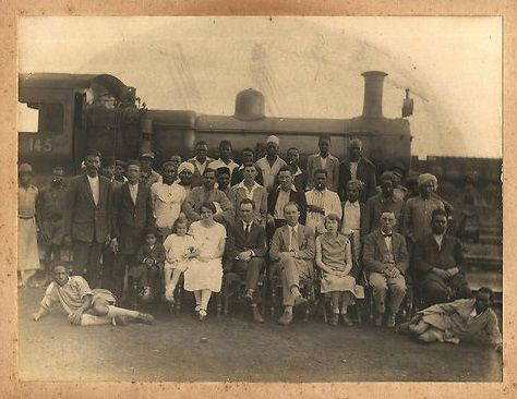
In August 1908, 58 Afrikaner families made the journey. They came by sea from South Africa to Mombasa, then by rail to Nakuru, then by ox-wagon across country — a trek of several weeks through difficult terrain, wagons regularly getting stuck in the mud of the plateau’s black cotton soil. Led by Jan van Rensburg, they arrived at Sergoit Hill near present-day Eldoret on 22 October 1908. The hill — where one of the wagons had a heavy safe fall off and could not be lifted back — became the symbolic founding point of the settlement. One version of the story claims the Boers simply decided to build a bank around the safe. Whether true or not, it captures something real about the settlement’s character: practical, improvised, and slightly absurd.
The land they took up had been Nandi grazing ground. Each family received a leasehold of between 800 and 5,000 acres, on condition that they would develop it within five years. The Nandi, who had not been consulted, were pushed off. What the Boers called “breathing space,” the Nandi called dispossession.
“To the Boers, Eldoret looked like their beloved kopjes in the Transvaal. They outspanned at once, saying: ‘Here is a land where our women can breed in space.'”
— Negley Farson, Last Chance in Africa, 1947
Farm 64: How a Town Was Born
The settlement that would become Eldoret began not with a plan but with a post office. In 1910, Farm 64 — named for its survey map number, which happened to be exactly 64 miles from the railhead at Kibigori — was leased to a Boer named Willie van Aardt, who found the land unsuitable for farming. When the Postmaster General, J. Gosling, passed through and identified the site as ideal for a postal facility, van Aardt began accepting applications for business plots on his farm. The post office was built. Shops followed. A trading centre materialised almost by accident.
The locals, unable to pronounce “Sixty-Four,” called it Sisibo — a phonetic approximation that tells its own story about the gap between colonial naming and local experience.
In 1912, Governor Sir Percy Girouard visited and summoned the settlers to give their town a proper name. The suggestions were a window into the colony’s competing cultures: Sirikwa (acknowledging the plateau’s ancient inhabitants), Sosiani (the river that ran through it), Bado Kidogo (Swahili for “not yet” — a joke, or perhaps a quietly accurate assessment), and Girouardfontein, which the governor himself vetoed on the grounds that his French name would be too difficult to pronounce.
The agreed name was Eldare — a Maasai word meaning “a place of hard rocks” or, in some translations, “stony river,” referring to the rocky course of the Sosiani. The governor suggested adding a ‘t’ to make it sound more Nandi-like (Nandi nouns typically end in a consonant). The clerk wrote Eldoret instead of Eldaret. The gazette published it. Eldoret it became.
The Nandi Resistance and the Cost of the Plateau
The Boers did not take the plateau without a fight. The Nandi had already spent a decade resisting British attempts to control their territory. Their orkoiyot, Koitalel arap Samoei, had led armed resistance to the Uganda Railway’s construction through their land since 1895 — disrupting surveying parties, raiding supply lines, and demonstrating a military capacity that no other Kenyan community had sustained for so long. The British launched five full military expeditions against the Nandi before finally engineering Koitalel’s assassination at a staged peace meeting in 1905.
The defeat of the Nandi opened the plateau. But opening it and securing it were different things. Nandi communities that had farmed and grazed the Uasin Gishu for generations found themselves progressively squeezed onto the Nandi Reserve — land designated by the colonial administration as the area within which the Nandi were permitted to live. The best agricultural land went to European settlers. The Nandi, like the Maasai before them and the Kikuyu in the central highlands, were transformed from landowners into squatters, labourers, and reserve residents on land that had been theirs.
Between 1906 and 1936, as Eldoret grew, Nandi, Luhya, Kikuyu, and Luo communities migrated onto settler farms as labour — farming land their own communities had previously occupied, now as workers rather than owners. The colonial land system that had been built across Kenya was replicated here in miniature, with the Uasin Gishu plateau as its most productive expression.
The Railway and the Grain Basket (1924–1940s)
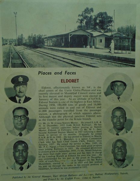
For the first decade of its existence, Eldoret was isolated. The Uganda Railway’s main line ran through Nakuru and Kisumu to the south, and Eldoret sat off the main route. Ox-wagons and mule teams were the primary means of moving grain from the plateau to the coast — a slow, expensive process that limited how much the settlers could produce and export.
That changed in 1924, when a railway branch from Kibigori reached Eldoret, connecting the plateau to the main Uganda line and onward to Mombasa. The effect was immediate and transformative. What had been a remote farming outpost became a logistics hub. Grain flowed east to the coast. Machinery and consumer goods flowed west. The settler farms of the Uasin Gishu plateau — already producing maize, wheat, and pyrethrum for export — scaled up rapidly. Eldoret became Kenya’s grain capital.
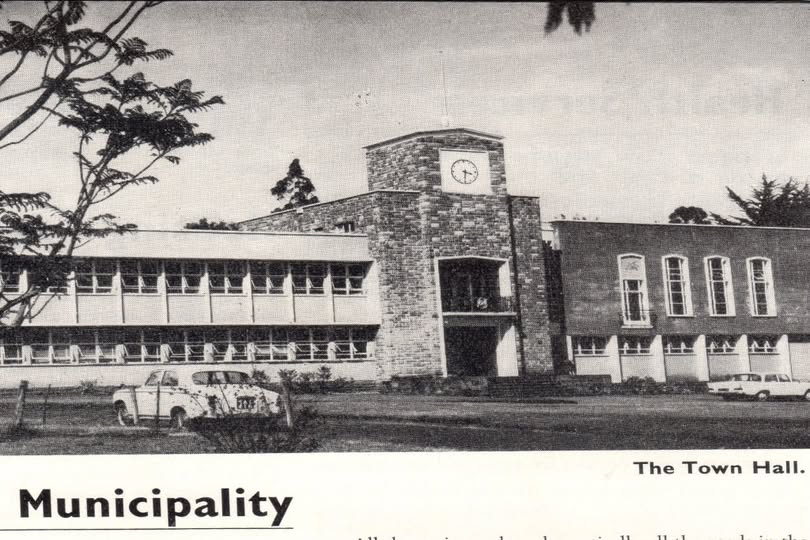
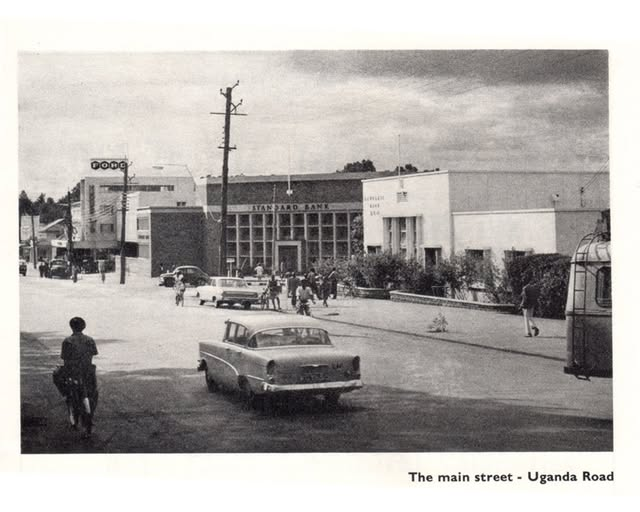
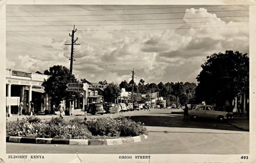
The infrastructure of a proper town followed quickly. Piped water from the Sosiani River arrived in 1928. Electricity came in 1933. A small airport opened the same year. By the late 1930s, Eldoret had a courthouse, a hospital, banks, churches, schools, and the full apparatus of a colonial administrative centre — serving a European population that farmed the surrounding plateau and an African population that worked on their farms, lived in designated locations on the edge of town, and was legally prohibited from owning land in the area their ancestors had grazed.
The settler community that built this town was unusually diverse by Kenyan standards. Alongside the Boer founding families — many of whom remained for generations, their descendants still present in the region today — came British settlers, Indian merchants who had followed the railway westward, and a small community of Greek traders. The Boer influence left its mark in place names, farming methods, and architecture. A number of the old stone farmhouses on the plateau bear a distinct Afrikaner character, built to plans brought from the Transvaal and adapted for the highland climate.
Independence and the Land Question
When Kenya became independent in December 1963, the Uasin Gishu plateau faced the same unresolved question that hung over every former White Highlands district: what would happen to the land?
The Lancaster House compromise — that land would be transferred on a “willing buyer, willing seller” basis, financed by British government loans — played out here as it did elsewhere. Some European settlers sold up and left. Others stayed, took Kenyan citizenship, and continued farming. The land buying schemes that the post-independence government organised allowed African families to purchase former European farms in cooperative arrangements — schemes that tended to benefit those with political connections and capital rather than the communities from which the land had originally been taken.
For the Nandi, the post-independence settlement was bitterly inadequate. The Nandi Reserve had confined them to a fraction of their ancestral territory, and independence did not automatically restore what colonialism had taken. Some Nandi land was returned through formal buying schemes. Much was not. The land question on the Uasin Gishu plateau — as across the Rift Valley — remained unresolved, and that unresolution periodically erupted into violence, most catastrophically in the post-election crisis of 2007–2008, when Eldoret became the epicentre of some of the worst ethnic violence in Kenya’s post-independence history. The church at Kiambaa, where over 30 people sheltering inside were burned alive in January 2008, stands as the most searing memorial of what unaddressed land grievances can become.
The Moi era brought its own transformations. Daniel arap Moi, Kenya’s second president and a Tugen from the broader Kalenjin community, was born in Kamagut ward on the edges of what is now Eldoret. His 24-year presidency from 1978 to 2002 brought significant investment to the region — Moi University was founded in Eldoret in 1984, the first public university outside Nairobi, as a deliberate act of regional development. The Moi Teaching and Referral Hospital, now one of Kenya’s largest healthcare facilities, was established in the same period. Eldoret’s growth during the Moi era reflected both genuine development and the patronage politics of a president investing in his home region.
The City of Champions: Running and Eldoret’s Global Identity
If you asked anyone outside Kenya what they associate with Eldoret, the answer would not be grain farming or colonial history. It would be running.
Eldoret and the surrounding Rift Valley highlands have produced a disproportionate share of the world’s greatest distance runners — a concentration so extraordinary that it has attracted researchers, journalists, coaches, and athletes from across the globe trying to understand what produces it. The altitude helps: at over 2,000 metres, the thin air forces the cardiovascular system to adapt in ways that produce measurable advantages at sea level. The culture helps too: running to school, running for transport, a community that celebrates athletic achievement and invests in it.
The tradition began long before modern athletics. The Nandi and Kalenjin peoples of the Uasin Gishu plateau were known for their endurance as warriors and hunters — running long distances as a practical skill long before it became a sport. The first Kenyan runner to bring this tradition to global attention was Kipchoge Keino, born in Nandi Hills near Eldoret in 1940, who won gold at the 1968 Mexico City Olympics in the 1,500 metres — famously jogging to the stadium after getting stuck in traffic, then defeating the world record holder. Keino did not just win races. He opened a door that hundreds of runners have walked through since.
The roll call of Eldoret-area champions reads like a who’s who of modern athletics. Henry Rono set four world records in 81 days in 1978. Wilson Kipketer — Eldoret-born, Danish-naturalised — ran the 800m faster than anyone alive for years. Eliud Kipchoge, who trains at the Kaptagat camp in the hills above Eldoret, became the first human being to run a marathon in under two hours in 2019, then set the official world record at 2:01:09 at the Berlin Marathon of 2022. Brigid Kosgei, Faith Kipyegon, Emmanuel Mutai — the list extends across every distance from 800 metres to the marathon.
The IAAF High Altitude Training Centre established in Eldoret formalised what coaches had known for years: that training at altitude in a community with a deep running culture produced results that were difficult to replicate anywhere else. Athletes from Jamaica, the United States, and Europe now come to train in the hills around Eldoret, running on the same dirt roads and forest tracks as the Kenyan champions they are trying to beat.
William Ruto, Kenya’s current president, was born in Kamagut ward on Eldoret’s western edge — the second consecutive president with deep roots in the Eldoret region, following Moi. The political weight of the Rift Valley in Kenyan national politics is not incidental to Eldoret’s history. It reflects the demographics, economic importance, and cultural identity of a region that has been central to the Kenyan story since independence.
Eldoret Today
Eldoret was formally conferred city status on 15 August 2024, becoming Kenya’s fifth city after Nairobi, Mombasa, Kisumu, and Nakuru — recognition of a growth trajectory that has made it one of East Africa’s fastest-expanding urban centres. Its population of roughly 475,000 (2019 census) is expected to approach one million by 2030.
The city that began as Farm 64 now hosts two major universities, the country’s second-largest referral hospital, an international airport, a substantial manufacturing sector, and the largest concentration of professional distance runners anywhere in the world. The Uasin Gishu plateau that Sirikwa herders grazed, that Maasai warriors contested, that Nandi farmers cultivated, that Boer refugees colonised, and that British administrators surveyed and subdivided, is today Kenya’s most productive agricultural zone — and home to a sporting tradition that has no parallel on earth.
The misspelling in the 1912 gazette notice gave the city its name. Everything else it built itself.
Further Reading
- The Iloikop Wars — the Maasai civil wars that destroyed the Uasin Gishu Maasai and created the vacuum the Nandi filled
- Koitalel arap Samoei — the Nandi leader who resisted the railway and was assassinated at a staged peace meeting
- The Kipsigis — the closely related Kalenjin people who share the Uasin Gishu plateau’s history
- Kipchoge Keino — the Eldoret-born runner who opened the door for Kenyan athletics
- Why Are Kenyans So Good at Running? — the science, culture, and history behind the Rift Valley running tradition
- Kenya’s White Highlands — the colonial land system that shaped the Uasin Gishu plateau
- Lords of the Plains: The Maasai at Their Peak — the world that existed on the plateau before the settlers arrived
- The Rails That Built a Colony — how the Uganda Railway extension transformed Eldoret in 1924
- The History of Nakuru — the neighbouring Rift Valley city with a parallel colonial history