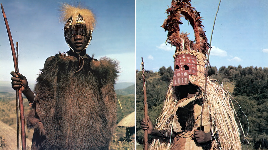
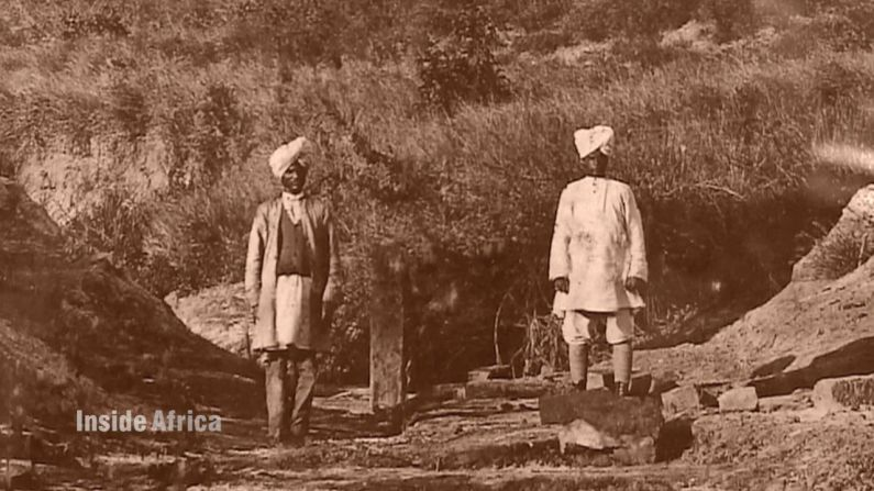
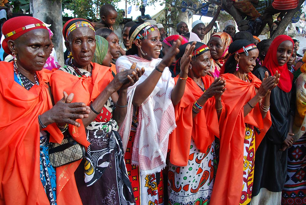
Long before Kenya existed as a nation, its land was home to dozens of distinct peoples — each with their own language, cosmology, and way of life. Today, 44 officially recognised ethnic groups share this territory, belonging to three great linguistic families: the Bantu, the Nilotic, and the Cushitic.
On the coast, the Mijikenda and Swahili built maritime civilisations linked to the Indian Ocean world, where Islam, trade, and Swahili culture fused over centuries. In the highlands, the Kikuyu, Meru, and Embu shaped the land and, later, the independence struggle. Across the arid north and open plains, the Maasai, Turkana, and Samburu developed ways of living that outsiders repeatedly underestimated — and repeatedly failed to erase. Smaller peoples, among them the El Molo of Lake Turkana and the Boni of the coast forests, carry knowledge systems found nowhere else on earth.
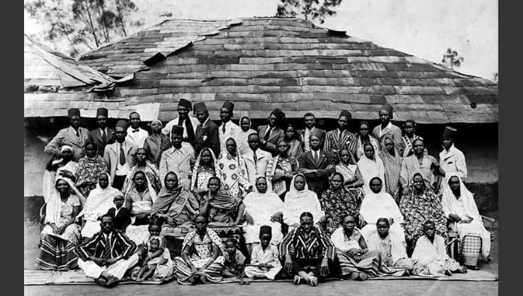
Colonial rule did not create these communities, but it redrew their boundaries, stoked rivalries, and decided which histories would be recorded and which forgotten. Independence brought new pressures: land conflict, political ethnicity, and the quiet erosions of globalisation. Some groups waited until the 21st century — the Nubians, the Makonde, the Kenyan Asians — to have their presence formally acknowledged by the state.
What follows is not a catalogue. It is an attempt to restore the depth behind the names — origins, migrations, beliefs, colonial encounters, and the present-day realities of each of Kenya’s 44 peoples.
Kenya’s 44 Tribes at a Glance
Kenya Ethnic Groups — Embeddable Widget BantuNiloticCushiticMultipleNubianA note on the list
Kenya’s 44 officially recognised ethnic groups are frequently cited as a settled fact. In practice, the number has shifted with every national census since 1948, and no single government document has ever listed all 44 in sequence. The Nubians were recognised as the 43rd group in 2009; the Makonde were also gazetted as the 43rd in 2016; and Kenyans of Asian origin became the 44th in 2017 — without any official accounting of the 43 communities that preceded them. What follows is the most complete list available, compiled from census records, gazette notices, and academic sources. Where a group’s position is contested or overlapping, we have noted it.
Jump to a people
Agikuyu (Kikuyu) · Luhya · Luo · Kalenjin · Kamba · Kisii (Abagusii) · Meru · Embu · Maasai · Samburu · Turkana · Rendille · Borana · Gabra · Orma · Somali · Pokot · Marakwet · Keiyo · Nandi · Tugen · Kipsigis · Sabaot · Terik · Ilchamus (Njemps) · Suba · Kuria · Tharaka · Taita / Taveta · Mijikenda · Bajuni · Swahili · Mbeere · Kenyan Asians and Arabs · Nubians · Pokomo · El Molo · Boni (Aweer) · Burji · Konso · Sakuye · Makonde · Aembu · Aari
Agikuyu (Kikuyu)
The Kikuyu are Kenya’s largest ethnic group, concentrated around the fertile central highlands surrounding Mount Kenya. They speak Gikuyu, a Bantu language closely related to Embu and Meru. Traditionally agriculturalists, the Kikuyu cultivated millet, bananas, and later maize and cash crops such as coffee. Land ownership was central to Kikuyu identity, structured around clans and patrilineal inheritance — and it is land, more than anything else, that explains the trajectory of their modern history.
In the colonial period, the Kikuyu were heavily affected by European land alienation, especially in the White Highlands, which displaced thousands of smallholders and created a class of landless labourers known as ahoi. This dispossession fuelled grievances that erupted in the Mau Mau rebellion (1952–1960), a militant uprising that the British called a terrorist insurgency and post-independence Kenya reframed as a liberation war. Figures like Dedan Kimathi and Waiyaki wa Hinga became symbols of resistance across generations. The protest songs of the Mau Mau period survive as a distinct cultural archive.
The Kikuyu entered independence holding enormous political influence: Jomo Kenyatta became Kenya’s first president, and Mwai Kibaki its third. That dominance has made them a focal point of Kenya’s recurring debates about ethnicity, land, and political access. The wounds of land ownership have never fully healed — Kikuyu settlers in the Rift Valley and the coast remain at the centre of disputes that periodically erupt into violence. The community’s story is, in many ways, the story of Kenya’s unresolved inheritance from colonialism.
Luhya
The Luhya are Kenya’s second-largest ethnic group, inhabiting the western counties of Kakamega, Bungoma, and Vihiga. They are not a single people in the strict sense — the Luhya identity is a political and administrative construction that binds together seventeen distinct sub-groups, including the Bukusu, Maragoli, Idakho, and Tiriki, each with its own dialect and traditions. What they share is Bantu language structure, a history of small-scale agriculture, and a western Kenyan homeland that colonial administrators consistently undervalued.
Colonial contact transformed the region into a labour reserve. Mission education spread widely, and by the mid-20th century the Luhya had produced many teachers, clerks, and civil servants — yet the region itself remained economically marginalised, a pattern that shaped post-independence demands for equitable development. The Bantu of Kavirondo, as colonial writers grouped them, built strong civic institutions despite neglect from Nairobi.
Luhya culture emphasises communalism, initiation ceremonies, and rituals tied to land and family. One of its most distinctive traditions is bullfighting — not the Spanish variety, but community spectacles in which prized bulls compete to establish prestige, still practised across Kakamega today. Politically, the Luhya have produced major national figures, from Masinde Muliro to Musalia Mudavadi, yet the sub-group divisions that make them culturally rich have also made them a political bloc that is large in theory and fragmented in practice. The call for Luhya unity before each election has become something of a national joke — and a serious source of frustration within the community itself.
Luo
The Luo are a Nilotic-speaking people who migrated southward from the Upper Nile region over several centuries, eventually settling along the shores of Lake Victoria in Nyanza. Their language, Dholuo, links them to related communities in Uganda, Tanzania, and South Sudan, making them part of one of the great Nilotic diaspora networks of East Africa. Traditionally fishermen, herders, and cultivators, the Luo built an economy around the lake’s resources and cattle wealth, with funeral practices and music as the twin pillars of cultural expression.
Early access to mission schools gave the Luo a distinctive presence in Kenya’s professional and intellectual life. By the mid-20th century, they had produced some of the country’s most prominent thinkers and politicians: Jaramogi Oginga Odinga, Kenya’s first vice president and its most persistent voice for land reform; Tom Mboya, the labour organiser and pan-Africanist whose assassination in 1969 sent a tremor through the country’s politics; and later Raila Odinga, who ran for president five times and became the face of Kenya’s opposition movement. The Kisumu Massacre of 1969 — in which security forces shot into a crowd during Kenyatta’s visit — scarred the relationship between the Luo and the Kenyan state for decades.
Culturally, the Luo are known for elaborate funeral rites, polygynous family systems, and a musical tradition — particularly benga — that has shaped Kenyan popular music. Kisumu, their main urban centre, has repeatedly been the flashpoint for national political tensions. Today, Luo identity straddles local tradition and urban cosmopolitanism — a community that has never been in political power nationally, and has built a formidable identity around that very fact.
Kalenjin
The Kalenjin are not a single tribe but a cluster of closely related Nilotic-speaking communities inhabiting Kenya’s Rift Valley. The group encompasses the Nandi, Kipsigis, Tugen, Keiyo, Marakwet, Sabaot, Pokot, and Terik — peoples who share age-set initiation systems, a history of cattle herding and highland cultivation, and a linguistic family that links them across a vast swathe of the valley. The name “Kalenjin” itself, meaning roughly “I tell you,” was popularised in the 1940s as a collective identity on a radio programme — a modern label for an ancient cultural cluster.
Their colonial history is bookended by two acts of fierce resistance. At the opening of the 20th century, the Nandi under Koitalel arap Samoei mounted one of the most sustained armed campaigns against British rule in East Africa, disrupting railway construction and defying military expeditions for nearly a decade before Koitalel was assassinated at a fake peace meeting in 1905. At the close of the colonial era, Kalenjin leaders pushed hard for majimbo — regional federalism — to protect their land from Kikuyu settlement. The compromise that emerged at independence satisfied neither side.
Globally, the Kalenjin are now most famous for an astonishing dominance in long-distance running — a phenomenon explored in depth in why Kenyans are so good at running, linked to altitude, cultural practices, and a community infrastructure built around athletic achievement. Politically, the community reached its peak influence under President Daniel arap Moi (1978–2002) and remains a significant electoral bloc. Land in the Rift Valley — who owns it, who was displaced, and who returned — is the unresolved question that surfaces in every election cycle.
Kamba
The Kamba — properly called the Akamba — inhabit southeastern Kenya in the counties of Machakos, Kitui, and Makueni. They speak Kikamba, a Bantu language closely related to Kikuyu and Meru, and their homeland, Ukambani, is semi-arid country that has shaped a culture of mobility, ingenuity, and long-range trade. Long before the colonial period, Kamba caravans were carrying ivory and other goods across hundreds of miles between the coast and the interior, making them one of the great trading peoples of pre-colonial East Africa.
The Kamba’s military bearing made them attractive to colonial recruiters. They were heavily enlisted into the King’s African Rifles, serving in both World Wars, and their reputation as disciplined soldiers persisted long into independence. Christianity and mission schooling reshaped community life, but traditional beliefs — particularly in prophecy and divination — survived alongside the new faith. The prophet Syokimau, who foretold the coming of the railway and the Europeans, remains a revered figure in Akamba spiritual identity. The intricate social codes around death, taboo, and the afterlife are explored in Kamba taboo traditions and the clan structures that organise community life.
Today the Kamba are celebrated for their artistry — woodcarving, basketry, and music — and for producing national political figures like Kalonzo Musyoka. But Ukambani’s recurring drought and water scarcity means the community’s most pressing story is ecological as much as political: how to sustain livelihoods in a landscape that is becoming more demanding, not less. Their full cultural history is one of the richest on this site.
Kisii (Abagusii)
The Kisii, also known as the Abagusii, live in the fertile highlands of Kisii and Nyamira counties in southwestern Kenya. They speak Ekegusii, a Bantu language distinct from their Luo and Kipsigis neighbours, and their homeland is one of the most densely populated rural areas in Kenya — a fact that explains both their intensive farming of bananas, maize, and tea, and the land pressure that has driven waves of migration to Nairobi and other cities.
Traditionally organised around clans and councils of elders, the Kisii placed initiation ceremonies at the centre of social life: male circumcision marked the passage into adulthood and membership in a generational cohort with specific duties and privileges. They are also Kenya’s master carvers of soapstone — the pink-and-white stone quarried around Tabaka Hills has become an international export and one of the country’s most recognisable art forms. Colonial officials who characterised the Kisii as “fiercely resistant to authority” were not wrong: British punitive expeditions subdued them in the early 1900s, but political activism remained in the community’s DNA. The Kisii Riots of 1908 were among the earliest organised expressions of defiance against colonial rule in the region.
Post-independence, the Kisii have built a reputation for educational achievement and entrepreneurialism that belies their image as a peripheral community. Land scarcity drives ambition outward: Kisii businesspeople and professionals are visible across urban Kenya. But the fertility of the highlands that built that drive is under mounting pressure from population growth, and the question of what Kisii culture looks like two generations from now — when land holdings have been subdivided again and again — is one the community is actively wrestling with.
Meru
The Meru occupy the northeastern slopes of Mount Kenya, in Meru County, and speak Kimeru, a Bantu language closely related to Kikuyu and Embu. Their oral traditions trace a migration from the coast — a journey inland that took generations and passed through what is now the Tana River region — before the community settled on the mountain’s fertile slopes and developed a complex agricultural and political system. The Meru are traditionally growers of millet, sorghum, bananas, and, in the modern era, coffee and tea that have brought considerable prosperity to the region.
The defining institution of Meru society is the Njuri Ncheke, a council of elders responsible for legislation, arbitration, and ritual leadership — a form of indigenous governance so robust that it has not only survived colonialism and independence but continues to operate today, issuing rulings on community matters that carry real social weight alongside formal law. During the colonial period, Meru experienced both the pressures of the cash-crop economy and the pull of resistance: Meru fighters participated in the Mau Mau rebellion, and the community provided significant logistical support to the forest fighters in the Aberdares and on Mount Kenya itself.
In contemporary Kenya, the Meru are politically significant within the larger Mount Kenya regional bloc, often aligned with Kikuyu interests while maintaining a distinct identity. The full history of the Meru people — their origins, migrations, and the evolution of the Njuri Ncheke — is among the most detailed accounts on this site. It is a community where tradition and modernity do not simply coexist but actively negotiate, season by season.
Embu
The Embu inhabit the southeastern slopes of Mount Kenya in Embu County, and speak Kiembu, a Bantu language related to Gikuyu and Kimeru. Their oral traditions do not describe a distant migration but an emergence from the mountain itself — ancestral myths centred on Mount Kenya as both physical homeland and sacred origin point, a cosmology that knits geography and identity into a single story.
Historically organised around clans and elder councils, the Embu practised mixed farming of millet, sorghum, beans, and later cash crops, supplemented by goat and cattle keeping. The community was smaller than its Kikuyu and Meru neighbours but shared their cultural architecture — initiation ceremonies, age-set systems, and a deep connection to land as the primary source of both wealth and belonging. Colonial intrusion arrived as dispossession: land alienation, forced labour, and the administrative folding of Embu identity into the larger Mount Kenya region. Like their neighbours, many Embu joined Mau Mau guerrilla units or were interned in British detention camps during the Emergency.
Post-independence, the Embu were absorbed into the “Mount Kenya bloc” in Kenyan politics and have rarely been treated as a distinct political constituency despite maintaining a clear cultural identity. Their agricultural productivity — bolstered by the mountain’s reliable rainfall — remains strong, and urban migration has expanded their presence in Nairobi and other towns. The Embu are a community whose story is easily obscured by larger neighbours, but whose depth of tradition, particularly around the mountain’s symbolism, rewards closer attention.
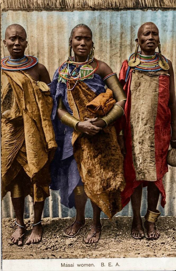
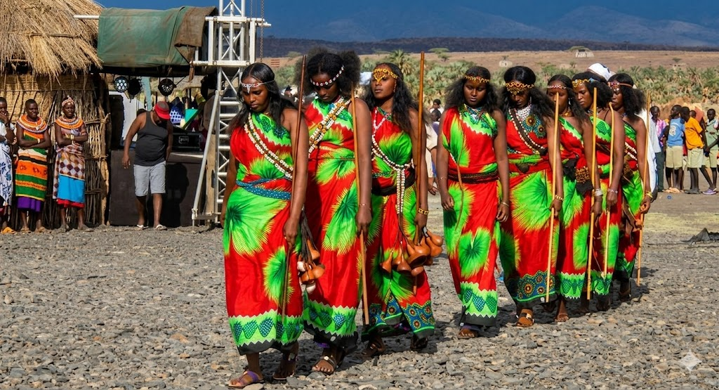
Maasai
The Maasai are a Nilotic-speaking people occupying the southern Rift Valley, mainly in Narok and Kajiado counties, with communities extending into northern Tanzania. They speak Maa, a language shared with the Samburu, and their culture is built around cattle — not merely as economic assets but as sacred gifts from God (Enkai), the medium through which relationships are formed, disputes resolved, and rituals performed. Their social organisation revolves around age-sets and the ilmurran warrior class, whose red shukas, ochre, and jumping dances have made the Maasai the most globally recognisable people in Kenya.
That visibility has a cost. The Maasai’s history of land loss is one of the most documented dispossessions in African colonial history: treaties in 1904 and 1911 stripped them of their best grazing lands in the Rift Valley, ostensibly for settler farms and later for wildlife reserves. The irony that Maasai pastoralists were removed to create the wilderness that tourists now pay to see is not lost on the community. The Maasai prophecy — a vision by the laibon Batian that foretold catastrophe in the form of strange animals crossing the land — is remembered as an uncanny anticipation of the railway’s arrival.
Modern Maasai life is defined by the tension between pastoral tradition and the forces pressing against it: climate change shrinking grazing land, conservation policies restricting movement, tourism economies that commodify culture without adequately compensating communities, and an education system that draws young people toward cities. The community is not passive in the face of these pressures — Maasai advocates and lawyers have been central to land rights movements across East Africa. But the question of what it means to be Maasai in 2026 is one with no easy answer.
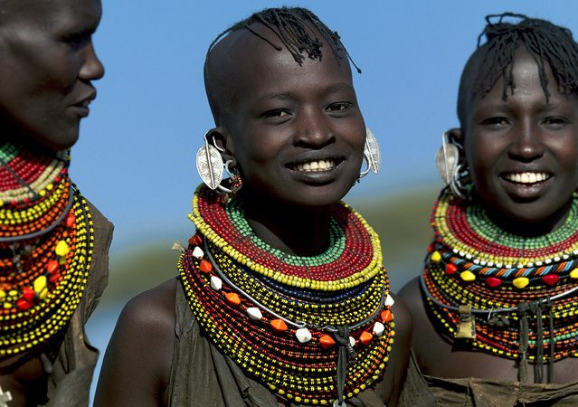
Samburu
The Samburu are closely related to the Maasai, sharing the Maa language in a distinct northern dialect and a broadly similar cultural architecture of age-sets, cattle wealth, and warrior traditions. They inhabit Samburu County and parts of the northern Rift Valley — a more arid, remote landscape than the Maasai’s southern plains, which has shaped both their adaptation and their relative isolation from Kenya’s mainstream political economy.
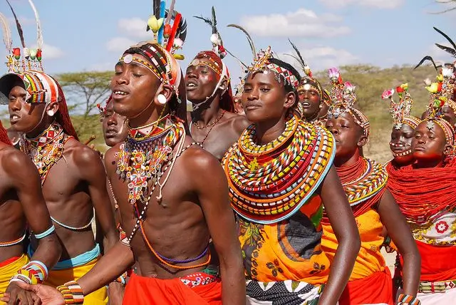
Samburu society is structured around age-sets, with young moran (warriors) holding ritual and protective responsibilities before graduating into elderhood. Polygyny, livestock wealth, and elaborate initiation ceremonies define social status. Samburu attire — layered beadwork, ochre-dyed skin, distinctive hairstyles — remains highly visible and has made the Samburu, like the Maasai, a frequent subject of photography and cultural tourism. Their territory fell within the Northern Frontier District under colonial rule, which meant a combination of enforced isolation and near-total neglect of infrastructure and services.
The Samburu’s most overlooked neighbours are the El Molo, Kenya’s smallest people, with whom they have a long history of contact and gradual cultural absorption. Today, the Samburu face drought, land pressure, and limited state services — challenges shared across Kenya’s pastoral north. At the same time, their cultural resilience is genuine rather than performed: the Samburu maintain initiation, age-set governance, and pastoralism not because tourists find it picturesque, but because these systems continue to organise real community life.
Turkana
The Turkana inhabit the arid northwestern region of Kenya — Turkana County, bordering Uganda, South Sudan, and Ethiopia — and represent one of the country’s most dramatic examples of a community shaped entirely by its landscape. They speak Ng’aturkana, a Nilotic language related to Ateker groups like the Karamojong of Uganda, and their traditional economy is built around camels, cattle, goats, and donkeys, with fishing in Lake Turkana as a vital supplement in lean years.
Turkana social organisation is built around clans, livestock wealth, and age-set hierarchies. Raiding — both for cattle and territorial control — has historically been central to Turkana identity, producing a reputation as formidable warriors that made colonial subjugation difficult and incomplete. The region was incorporated into the Northern Frontier District with minimal investment, and the legacy of that neglect shapes everything from road infrastructure to hospital density today. Turkana resistance to colonial rule was persistent and costly, and largely unrecorded in mainstream Kenyan histories.
In recent decades, Turkana County has been transformed by two external forces: the discovery of oil reserves and the development of a massive wind power project on the lake’s shores. Whether these will benefit the Turkana themselves or simply extract wealth from their land under new management is a live and unresolved debate. The community has seen this dynamic before. Lake Turkana — the jade sea — remains the physical and spiritual centre of Turkana life, but its water levels are falling and the communities around it are adapting under pressure. The Turkana story is Kenya’s hardest question about development, displacement, and who gets to define progress.
Rendille
The Rendille live in northern Kenya, primarily in Marsabit County, in one of the most demanding landscapes on the continent. They speak a Cushitic language closely related to Somali and Oromo, and centuries of contact with Nilotic neighbours — particularly the Samburu — have added layers of cultural exchange that make the Rendille a living example of how identity forms at crossroads. Their homeland is largely desert, and their response to it is the camel: the animal around which Rendille economy, ritual, and social life revolve.
Traditionally, the Rendille combined pastoralism with a strong ritual system organised around age-sets — a structure borrowed, in part, from their Nilotic neighbours, an unusual case of a Cushitic people adopting Nilotic social forms. Their religion centred on devotion to Waaq, a high god shared with Oromo traditions, and on rituals tied to livestock fertility and protection. Colonial officials grouped the Rendille within the Northern Frontier District, which meant decades of deliberate underdevelopment — no schools, no roads, and governance by restriction rather than investment. The Northern Frontier District is one of colonial Kenya’s least examined legacies.
Today the Rendille are a small but distinctive community caught between two gravitational pulls: the Samburu, with whom intermarriage is common and whose dress and culture have significantly influenced Rendille practice, and the Cushitic world of Borana and Somali identity. Climate change is not abstract here — it is the shrinking of water sources, the death of livestock, and the forced sedentarisation of families whose entire culture was built on movement. The Rendille’s camel-centred world is one of the most distinctive on this site.
Borana
The Borana are Cushitic-speaking pastoralists spread across northern Kenya — mainly Marsabit and Isiolo — and southern Ethiopia, where the larger Oromo nation to which they belong has its heartland. They speak the Borana dialect of Afaan Oromo, and their most celebrated cultural institution is the gadaa system: an age-grade governance structure that rotates leadership and ritual authority every eight years, producing a remarkably sophisticated system of democratic accountability that long predates modern elections.
Livestock — cattle and camels above all — are the foundation of Borana economy and social life. Ritual leaders called abba gadaa preside over governance, while clan councils regulate grazing rights and community disputes across vast shared territories. Colonial partition disrupted Borana territory profoundly: the boundary between Kenya and Ethiopia cut through ancestral grazing lands, dividing families and creating cross-border identities that persist to this day. Integration into the Northern Frontier District brought the usual combination of neglect and restriction.
The Borana are politically influential in northern Kenya and increasingly urban, with a significant presence in Isiolo town. Their Islamic identity has deepened over the past century, sitting alongside rather than replacing the gadaa system. Conflicts with Somali, Gabra, and Rendille communities over grazing rights remain frequent — the product of climate stress, shrinking pasture, and political boundaries that carve up ecosystems that pastoral communities need to use flexibly. The gadaa system, meanwhile, has attracted international attention as a model of indigenous governance, nominated for UNESCO’s Intangible Cultural Heritage list.
Gabra
The Gabra live in northern Kenya, mainly in Marsabit and Moyale, and are Cushitic camel pastoralists closely related to the Borana. They speak a dialect of Oromo and inhabit some of Kenya’s most extreme desert terrain — the Chalbi Desert and the Kaisut Depression — where survival depends entirely on mobility, clan solidarity, and the camel’s extraordinary capacity to travel long distances without water.
Gabra society is clan-based, with elaborate cooperation systems around wells, grazing rotations, and dry-season migration routes. Their spiritual life historically revolved around Waaq — the sky god shared with other Cushitic peoples — though most Gabra are now Muslim, a conversion that unfolded gradually through contact with Somali traders. Camels remain their most valued animals, associated with wealth, status, bridewealth, and ritual sacrifice.
Colonial administration categorised the Gabra as frontier tribespeople and left their region almost entirely undeveloped, a neglect that independence did little to reverse. Today they face the same constellation of pressures as their northern neighbours: recurring conflict with Borana and Rendille communities over pasture and water, climate stress that is making traditional migration routes unsustainable, and a generation of young people weighing nomadism against the possibilities of education and urban life. Despite these pressures, the Gabra maintain distinctive cultural festivals celebrating camel wealth and oral traditions that encode centuries of ecological knowledge about how to survive in one of Earth’s harshest places.
Orma
The Orma live primarily along the Tana River delta in Tana River County, one of Kenya’s least-visited regions and one of its most complex in terms of overlapping ethnic claims. They speak Orma, a Cushitic language closely related to Somali, and trace their ancestry to Oromo migrations from Ethiopia that brought them to the coast centuries ago. Over time, many adopted Islam through contact with Swahili coastal traders, and their identity today reflects this blending of Cushitic pastoralism and Indian Ocean Islamic culture.
Historically, the Orma were semi-nomadic cattle and goat herders, supplementing livestock with small-scale riverine farming. Their relationship with the Pokomo farmers downstream is Kenya’s longest-running land and water conflict: two communities with incompatible land use systems sharing a single river, repeatedly tipping into violence when drought or political manipulation intensifies the pressure. Colonial incorporation into Coast Province marginalised the Orma relative to Swahili and Arab coastal elites, and their grazing systems were repeatedly disrupted by conservation projects and land alienation.
The Tana River Delta is one of Kenya’s most ecologically significant — and most contested — landscapes. The Orma’s future is bound up with how Kenya resolves the competing claims of pastoralists, farmers, conservation projects, and large-scale irrigation schemes on a river system that cannot sustain all of them at once. The community’s cultural pride remains intact, anchored in their pastoral identity and Islamic faith, but the structural conditions of their lives have rarely been more precarious.
Somali
The Somali are one of the largest Cushitic-speaking peoples of the Horn of Africa, with a significant Kenyan population in Garissa, Wajir, and Mandera counties — collectively known as the North Eastern Province. They speak Somali, practice Islam as a defining faith, and organise social life through an elaborate system of clan genealogies that determine identity, alliance, and conflict resolution. In Kenya, Somali identity has always been shaped by cross-border ties: the boundary between Kenya and Somalia cuts through a single pastoral and cultural zone.
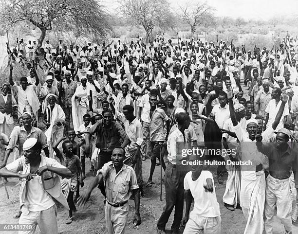
The colonial incorporation of the Somali into Kenya was contested from the beginning. During decolonisation, a majority in the region voted to join Somalia rather than the new Kenyan state, but Britain overrode the result in the interest of territorial integrity. The consequences were immediate: the Shifta War (1963–1968) was a brutal counter-insurgency that left deep scars — forced villagisation, collective punishment, and a collective memory of state violence that shaped Kenyan Somali political consciousness for generations.
Today, Kenyan Somalis are among the country’s most visible entrepreneurs, with Nairobi’s Eastleigh neighbourhood — nicknamed “Little Mogadishu” — functioning as a regional commercial hub that channels trade across East Africa. This economic dynamism coexists with persistent stereotyping and security scrutiny. The community navigates a dual suspicion: from the Kenyan state, which has repeatedly treated Somali identity as a proxy for insecurity, and from within Somalia, which no longer recognises their claim. What Kenyan Somalis have built in spite of these pressures is a story of resilience that deserves far more attention than it receives.
Pokot
The Pokot, sometimes called Suk in older literature, are a Kalenjin-speaking Nilotic people occupying West Pokot and parts of Baringo County. Their territory spans two very different ecological zones: arid lowlands where pastoralism and cattle raiding define life, and fertile highlands where farming of sorghum, millet, and maize is the foundation of the economy. The Pokot are, in effect, two communities sharing a name — highland farmers and lowland herders — and the cultural gap between them is wider than the geographic one.
Pokot society is structured around age-sets, clan affiliations, and the centrality of cattle to marriage, status, and ritual. Initiation ceremonies mark the transition into adulthood with scarification, dance, and communal obligation. Colonial officials read the lowland Pokot’s cattle raiding against their Turkana, Karamojong, and Marakwet neighbours as simple criminality, rather than as a system of wealth redistribution and territorial negotiation with its own complex logic. The response was coercive policing rather than investment, and the Pokot were integrated into Kenya through force rather than development.
Today cattle rustling remains a reality in West Pokot, periodically escalating into cross-border violence with the Turkana and Uganda’s Karamojong that leaves dozens dead and thousands of livestock displaced. But the picture is not static: education, mobile phones, and road infrastructure are slowly diversifying livelihoods, and a growing cadre of Pokot politicians and professionals are reshaping what it means to belong to this community. The Pokot are adapting, on their own terms, at their own pace.
Marakwet
The Marakwet are a Kalenjin sub-group inhabiting the Elgeyo-Marakwet County escarpments and Kerio Valley — a dramatic landscape of cliffs, river gorges, and terraced hillsides that has shaped a distinctive agricultural civilisation. They speak Marakwet, a Nilotic dialect, and are most remarkable for a system of irrigation canals — some estimated to be several centuries old — that channel water from highland rivers across the escarpment face into terraced farms below. This is indigenous hydraulic engineering of a sophistication rarely acknowledged in mainstream accounts of African history.
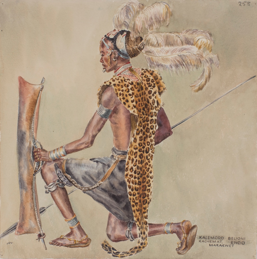
Marakwet society is organised through age-sets, clan systems, and elder councils that regulate both social life and the communal management of irrigation infrastructure. The canals are collectively maintained and governed by strict customary rules about water allocation and repair responsibility — a system that has proven more durable than many colonial-era replacements. Farming of millet, sorghum, maize, and beans, alongside cattle and goat keeping, provides a mixed and relatively resilient livelihood base.
Colonial administrators grouped the Marakwet with other Kalenjin-speaking peoples, limiting recognition of their distinct engineering heritage. Today they contribute significantly to Kenya’s athletics tradition — like most Rift Valley communities, they produce world-class long-distance runners — but it is their irrigation knowledge that represents their most singular contribution. As semi-arid regions across Africa face water stress, the Marakwet canals are attracting renewed attention from researchers and development practitioners looking for models of indigenous water management that actually work.
Keiyo
The Keiyo live along the Elgeyo escarpment in Elgeyo-Marakwet County, occupying highland plateaus and the fertile valleys that drop toward the Kerio River. They speak a dialect of Kalenjin and are culturally related to the Nandi and Marakwet, sharing age-set structures, cattle wealth, and initiation ceremonies that mark generational roles. Their landscape — highland escarpments giving way to semi-arid valley floors — has produced a community comfortable with both pastoralism and mixed farming, growing millet, sorghum, and later maize alongside their herds.
Colonial administrators grouped the Keiyo with other “Nandi-speaking” peoples, a classification that limited recognition of their specific identity and contributed to their political marginalisation. They provided labour to settler farms and the railway network, remaining largely rural throughout the colonial period and into independence. Recognition as a distinct community within the larger Kalenjin family came gradually, shaped partly by athletics: the Keiyo have produced world-class long-distance runners who put the escarpment on the global map in ways that colonial administrators never anticipated.
Today, the Keiyo maintain strong clan ties and communal farming traditions while navigating land scarcity and youth unemployment. The escarpment landscape is central to their identity in a way that is difficult to overstate — the particular combination of altitude, terrain, and community that produced their athletic dominance is also what sustains their distinctiveness as a people. As administrative boundaries shift and Kalenjin identity is increasingly invoked as a political bloc, maintaining that distinctiveness requires active effort.
Nandi
The Nandi are one of the most prominent Kalenjin sub-groups, living in Nandi County and parts of Uasin Gishu. They speak Nandi, a Kalenjin dialect, and carry a history of resistance that distinguishes them even within a cluster of communities known for their fierce independence. In the late 19th century, when the Uganda Railway was being driven through the Rift Valley and British settlers were arriving in numbers, the Nandi under Koitalel arap Samoei mounted one of the most sustained armed campaigns against colonial rule in East African history — nearly a decade of raids, ambushes, and disruptions that cost the British significant resources before Koitalel was assassinated under a flag of truce in 1905.
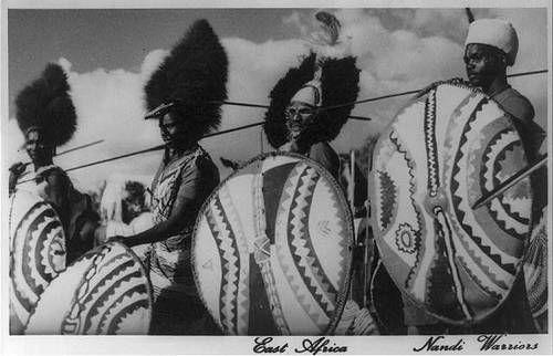
Nandi society was organised through age-sets, with warriors responsible for defence and elders for governance and ritual. Their economy blended cattle herding with cultivation of millet, sorghum, and maize. The colonial aftermath brought land alienation — European settlers occupied much of the fertile Nandi Hills — and a deep institutional memory of dispossession that continues to inform Nandi political consciousness.
Globally, the Nandi are now as famous for athletics as for resistance — a considerable number of Kenya’s world-record-holding runners come from this community and its immediate surroundings. The memory of Koitalel remains central to Nandi identity, invoked in political speeches, taught in local schools, and commemorated in a statue in Nandi Hills town. It is a community that understands, with precision, the difference between being absorbed and being defeated.
Tugen
The Tugen live in Baringo County, in the Rift Valley, and are part of the Kalenjin cluster. They speak a Kalenjin dialect and inhabit a territory that spans both fertile highlands and the semi-arid lowlands around Lake Baringo — a duality that has produced a community equally at home with farming and pastoralism. Traditionally, the Tugen organised social life through age-sets, with initiation ceremonies central to identity, and placed ritual emphasis on rainmaking and ancestral veneration in a landscape where rainfall is genuinely unpredictable.
Colonial incorporation brought taxation and labour migration, with many Tugen men working on settler farms and in urban centres. By the mid-20th century, the community’s most significant contribution to national life was not yet political but personal: a young man named Daniel Toroitich arap Moi, born in Sacho in Baringo, would become Kenya’s second longest-serving president, holding power from 1978 to 2002 and reshaping the country’s institutions in ways that are still being unpicked. The Tugen community’s fortunes during the Moi era were complicated — proximity to power brought benefits and, for some, complicity in its abuses.
Today the Tugen remain a predominantly rural community, balancing farming with herding while navigating land conflicts with neighbouring groups around Lake Baringo. The lake itself — whose water levels have risen dramatically in recent years, swallowing roads and homesteads — represents a new kind of threat that neither age-set governance nor political connections have yet found an answer to.
Kipsigis
The Kipsigis are the largest Kalenjin sub-group, inhabiting Kericho and Bomet counties in the Rift Valley highlands. They speak Kipsigis, a Kalenjin dialect, and their homeland — fertile, well-watered, and lying at altitude — is prime tea country. This geography has shaped a community that, unlike many of their pastoral Kalenjin relatives, became deeply integrated into the colonial cash-crop economy, and whose contemporary identity is built as much around tea estates as around cattle.
Historically, the Kipsigis combined herding with farming of millet, sorghum, and beans, structured by age-sets and cattle-based wealth systems. Initiation ceremonies embedded individuals in generational hierarchies with specific roles and obligations. Colonial authorities recruited them for settler farms and the military, and by the mid-20th century they were well established in tea cultivation — a crop that has brought relative prosperity but has also made them vulnerable to the price volatility of global commodity markets. Land disputes in Kericho and the contested Mau Forest remain sensitive, rooted in both colonial land alienation and the complex politics of post-independence settlement schemes that brought outsiders into Kipsigis territory.
The full history of the Kipsigis is one of the site’s more detailed explorations. Politically active within the larger Kalenjin bloc and economically significant through tea, the Kipsigis are a community whose story is inseparable from the contradictions of Kenya’s agricultural economy — who owns the land, who works it, and who captures the value it produces.
Sabaot
The Sabaot are a Kalenjin-speaking community inhabiting the slopes of Mount Elgon on the Kenya-Uganda border. They are closely related to the Sebei of Uganda — a cross-border kinship that colonial cartography severed in 1902 — and speak the Sabaot dialect of Kalenjin. Traditionally, they were cattle herders and farmers, cultivating the fertile volcanic soils of Mount Elgon and maintaining cross-border ties that the international boundary was never able to entirely erase.
Sabaot society is structured around clans and age-sets, with initiation rites playing a central social role. The rugged landscape of Mount Elgon fostered relative isolation that preserved traditions while limiting colonial development investment. Colonial administrators first classified the Sabaot as “Elgon Maasai” before grouping them under the broader Kalenjin umbrella — a shifting categorisation that reflects the arbitrariness of colonial ethnic taxonomy as much as any cultural reality.
Mount Elgon has been the site of some of Kenya’s most intense and localised land violence: the Sabaot Land Defence Force conflict of the mid-2000s, rooted in decades of contested resettlement on the mountain’s upper slopes, left hundreds dead and tens of thousands displaced. The underlying issue — who has the right to the forest land that was gazetted as a conservation area, and what happens to the people who were living there — was never resolved. The Sabaot’s story is a sharp illustration of how colonial land decisions create conflicts that detonate, unpredictably, generations later.
Terik
The Terik are one of Kenya’s smallest Kalenjin sub-groups, inhabiting areas near Nandi Hills in western Kenya. They speak Terik, a Kalenjin dialect, and their proximity to the more numerous Nandi has created a centuries-long pressure toward assimilation that makes their survival as a distinct group one of Kenya’s quiet stories of cultural tenacity.
Traditionally, the Terik practised a mix of farming and herding, with initiation ceremonies and age-sets structuring social life in ways broadly similar to other Kalenjin communities. The cultural borrowing between Terik and Nandi ran in both directions — intermarriage, shared ritual practices, and linguistic exchange — but the power imbalance was clear: it was Terik identity, not Nandi identity, that was at risk of being dissolved. Colonial officials largely overlooked the Terik, treating them as a peripheral subgroup not worth separate administrative attention, which deepened their marginalisation.
Today, many Terik identify as Nandi in public and administrative contexts while maintaining Terik identity within the family and community. Cultural revival efforts — documentation of the Terik language, oral history projects, local advocacy for recognition — are ongoing but fragile. The Terik represent a question that applies to dozens of small communities across Kenya: at what point does assimilation become erasure, and who gets to decide?
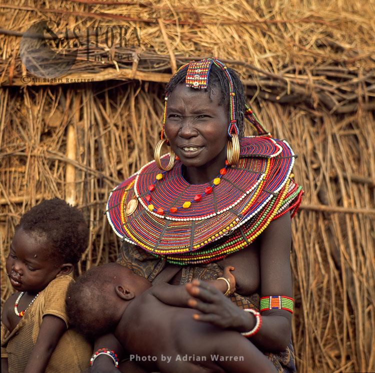
Ilchamus (Njemps)
The Ilchamus — more widely known by the colonial name Njemps — are a Maa-speaking Nilotic people living along the southern and southeastern shores of Lake Baringo in Baringo County. With a population of roughly 50,000, they are Kenya’s second smallest officially recognised ethnic group. Their name carries history in it: Ilchamus is a Maasai word meaning “people who can see into the future,” while Njemps was the label imposed by European administrators who encountered them in the 19th century.
Their origin is debated. One account holds that they descended from a Samburu section called Il-Doigolo, which separated in the mid-18th century. Another suggests they are remnants of the Il-Kwavi Maasai, defeated in clan wars and displaced southward to the shores of Lake Baringo. What is distinctive is what happened next: rather than maintaining a purely pastoral way of life, the Ilchamus developed a sophisticated system of irrigation agriculture along the lakeshore — making them the only cattle-herding community in Kenya that also fishes and irrigates. Their canoes, called kaldich, were built from lightweight ambach wood and steered across the lake’s freshwater surface. Neighbouring pastoralists, for whom fish is a cultural taboo, regarded this combination of skills with a mixture of bemusement and respect.
Culturally, the Ilchamus share age-set structures, warrior traditions, and beadwork with the Maasai and Samburu. Colonial administrators largely ignored them, folding their territory into Baringo District without infrastructure investment. Today the Ilchamus face land pressures, resource conflicts with Tugen and Pokot neighbours, and the erosion of the irrigation knowledge that once set them apart. Cultural documentation efforts by the National Museums of Kenya are working to record traditions that risk being absorbed into the wider Maa-speaking world — an irony for a people whose name means those who see the future.
Suba
The Suba live along the shores of Lake Victoria and on its islands — particularly Rusinga and Mfangano — in what is now Homa Bay County. They speak Suba, a Bantu language related to Kuria and other Great Lakes Bantu tongues, and trace their origins to migrations from Tanzania in the 18th and 19th centuries. Traditionally, the Suba were fishermen and farmers, with clan structures shaping community life and the lake providing the central resource around which identity was organised.
The Suba story is partly a story of linguistic survival against long odds. Their proximity to the Luo, who arrived on the lakeshore in larger numbers and with significant cultural prestige, created enormous assimilation pressure. Over generations, many Suba adopted Dholuo as their primary language, attending Luo-speaking schools, intermarrying, and participating in Luo political structures. Colonial administrators accelerated this by grouping the Suba administratively with the Luo, treating their distinct identity as irrelevant to governance.
The Suba language revival movement that emerged in the late 20th century is one of Kenya’s more remarkable cultural stories: linguists, community elders, and activists working together to document, standardise, and reintroduce a language that had retreated almost entirely into domestic use. Whether the revival can take root in a generation that grew up speaking Dholuo and English is genuinely uncertain. But the effort itself — the insistence that an identity worth having is worth the work of maintaining it — says something important about what the Suba see when they look at the lake their ancestors crossed.
Kuria
The Kuria live in Migori County along the Kenya-Tanzania border, a geographic position that has always defined their identity. They speak Kuria, a Bantu language related to Kisii and other Great Lakes Bantu tongues, and are mixed farmers and pastoralists — growing sorghum, maize, and bananas while keeping cattle and goats. The Abakuria had a reputation as formidable warriors, and their history of livestock raiding against Maasai and Luo neighbours created a complex web of conflict and alliance that persists in attenuated form today.
The 1902 boundary between Kenya and Tanzania cut directly through Kuria territory, creating cross-border families and identities that the border has never been able to fully contain. Cattle and people still move across it. Colonial rule brought Kenya’s Kuria into administrative structures dominated by their more numerous neighbours, and their political marginalisation — as a small community in a border county — has been a consistent feature of post-independence life.
Kuria culture places initiation ceremonies at the centre of identity: age-sets, circumcision, and the communal obligations they create remain the primary framework through which young Kuria understand their place in the world. Bride price, cattle wealth, and clan networks continue to organise social relationships. It is a community whose cultural life is vivid and whose political visibility is low — the kind of gap that this archive is specifically designed to address.
Tharaka
The Tharaka inhabit Tharaka-Nithi County, southeast of Mount Kenya, in a landscape that transitions from the mountain’s well-watered slopes into increasingly arid lowlands. They speak Kitharaka, a Bantu language closely related to Kimeru, and share cultural similarities — initiation systems, clan governance, elder councils — with the Meru and Embu communities to their north and west. Oral traditions link them to migrations from the Mount Kenya region, placing them within the same broad cultural family as their neighbours.
Traditionally, the Tharaka were agriculturalists, cultivating sorghum, millet, and later maize, supplemented by livestock keeping suited to their semi-arid terrain. Clan-based social systems and councils of elders regulated community life, with initiation rituals marking generational transitions. Colonial authorities routinely grouped the Tharaka with the Meru, limiting recognition of their distinct dialect and traditions — a bureaucratic convenience that contributed to their cultural marginalisation in the administrative record.
Post-independence recognition within Tharaka-Nithi County elevated their visibility, and current efforts to preserve Kitharaka language and oral literature are building a record that the colonial period largely failed to create. The Tharaka are primarily agricultural — drought and land scarcity are pressing challenges — but their determination to maintain a distinct identity within a Mount Kenya region that often speaks with one political voice is itself a form of cultural resistance. Small in numbers, specific in tradition, they are exactly the kind of community a history project like this one exists to document.
Taita / Taveta
The Taita and Taveta inhabit Taita-Taveta County in southeastern Kenya, near the Tanzanian border, in a landscape of striking contrasts: the cool, fertile Taita Hills rising sharply from the dry plains that stretch toward Tsavo. They speak Kitaita and Kitaveta, Bantu languages influenced by Swahili, and their histories, while linked, are distinct — the Taita highland farmers, the Taveta riverine farmers and fishermen who settled near the Lumi River under the shelter of a forest that outsiders found impenetrable.
Taita culture is anchored in the hills themselves. Sacred groves, ritual caves, and the skulls of ancestors stored in clan shrines gave the Taita Hills a spiritual topography that missionaries found alarming and that archaeologists now recognise as one of the most intact systems of ancestor veneration in coastal Kenya. The Taveta, meanwhile, developed a reputation for welcoming outsiders — their fortified forest settlement sheltered traders, refugees, and, during the East African campaign of the First World War, became strategically significant terrain in the German-British battlefront.
Both communities were early adopters of Christian mission education, which gave them advantages in colonial civil service while simultaneously pressuring the ancestor traditions that defined their spiritual life. Today, Taita-Taveta’s economy is shaped by horticulture in the hills, sisal farming in the plains, and the massive tourism economy of Tsavo — a national park built partly on land that once belonged to them. The community’s challenge is to benefit from what surrounds them, rather than simply being surrounded by it.
Mijikenda
The Mijikenda are a cluster of nine related Bantu-speaking groups occupying the coastal hinterland of Kenya, mainly in Kilifi and Kwale counties. The nine sub-groups — Giriama, Digo, Duruma, Chonyi, Kauma, Kambe, Ribe, Rabai, and Jibana — speak closely related dialects and share a common origin narrative of migration from a place called Singwaya to the north. Their shared identity is expressed through the kaya: fortified forest settlements that served simultaneously as political centres, ritual sites, and defensive strongholds, governed by councils of elders.
Traditionally, the Mijikenda practised mixed farming, traded with Swahili and Arab coastal merchants, and maintained a spiritual system centred on sacred charms called fingo and elaborate ancestor rituals that the kayas were designed to house. Colonial intrusion disrupted this system with particular violence during the Giriama rebellion of 1913–14, led by the extraordinary Mekatilili wa Menza — one of the few women at the centre of a major anti-colonial uprising in East African history. British forces burned kayas, confiscated livestock, and forcibly moved the Giriama southward, breaking a system that had taken generations to build. The broader Mijikenda origins and identity are explored in depth on this site.
Today the kaya forests are recognised as UNESCO World Heritage Sites — a vindication that came too late for the elders who watched them burn, but has given the surviving kayas both legal protection and renewed cultural significance. The Mijikenda face land alienation, youth unemployment, and political marginalisation in a coastal economy dominated by tourism and real estate that rarely benefits those who were there first. But the kayas endure, and the councils that govern them still meet, and the vigango memorial sculptures that mark Mijikenda ancestors still stand in the forest clearings — improbable monuments to a persistence that defied the best efforts of colonial authority to erase it.
Bajuni
The Bajuni live along the Lamu archipelago and the northern coastal strip, with communities extending into southern Somalia — a maritime people whose world has always been defined by the sea rather than by national boundaries. They speak Kiswahili in a Bajuni dialect heavily influenced by Arabic, and their economy has traditionally been built around dhow sailing, fishing, boatbuilding, weaving, and salt harvesting. Their canoes and sailing vessels were the infrastructure of the northern Indian Ocean coastal trade for centuries.
The Bajuni trace their origins to a mixture of Bantu-speaking coastal populations, Arab settlers, and Somali contacts — an identity formed at the intersection of multiple migrations and trading relationships. They participated in the broader Swahili world but maintained their own dialect, their own fishing grounds, and a self-understanding tied specifically to the Lamu archipelago’s islands and channels. Colonial and postcolonial administrations marginalised them relative to the larger Swahili and Arab communities of the coast, and land alienation — particularly through the expansion of tourism infrastructure in Lamu — has repeatedly threatened their access to the shores on which their livelihoods depend.
Today the Bajuni are one of Kenya’s smallest coastal groups, and many have been absorbed into the wider Swahili identity that the coastal region presents to the outside world. But within Lamu’s historic stone town, the Bajuni dialect is still spoken in fish markets and boat yards, and the dhow-building tradition — a practice of extraordinary technical knowledge — is still alive, though fewer young hands are learning it each year. It is the kind of knowledge that, once lost, does not return.
Swahili
The Swahili are a coastal people concentrated in Mombasa, Malindi, and Lamu, and their story is inseparable from the story of the Indian Ocean world. They speak Kiswahili — a Bantu language with deep Arabic influence that has become Kenya’s national language and one of Africa’s great lingua francas — and they built, over many centuries, one of the most sophisticated urban civilisations on the continent. Islam on the coast shaped everything from architecture to poetry to governance, arriving not as colonial imposition but as commercial and intellectual adoption through centuries of Indian Ocean exchange.
The medieval Swahili city-states — Mombasa, Malindi, Pate, Lamu, Gede — were nodes in a trading network that stretched from the Persian Gulf to India to China. Mombasa’s history is among the richest on this site: a port city that was fought over by the Portuguese, the Omani Arabs, and the British, each leaving layers that the modern city still carries in its architecture, its food, and its tensions. The Swahili were not passive recipients of these waves but active negotiators — adopting, adapting, and sometimes resisting on their own terms. Their full cultural history is explored in depth here.
Colonial rule was a demotion for the Swahili: British administration favoured Indian and European commercial interests, sidelining the coastal Arab and Swahili elites who had managed trade for generations. The coastal land question — who owns the strip of land between the Indian Ocean and the Kenyan interior — remains unresolved at independence’s edge, with Swahili communities arguing that the post-colonial state never settled the debt it owes to those whose land was absorbed into the new nation without adequate reckoning.
Mbeere
The Mbeere inhabit the southern and eastern parts of Embu County, in terrain that transitions from Mount Kenya’s productive slopes into more arid lowlands where farming requires more effort and more luck. They speak Kimbeere, a Bantu language closely related to Kiembu and Gikuyu, and are culturally close to the Embu and Kikuyu while maintaining a distinct dialect and tradition. Their most celebrated practice was beekeeping: the Mbeere were renowned honey producers, managing hive systems in the dry woodlands with a knowledge developed over generations.
Traditionally, the Mbeere practised mixed farming — millet, sorghum, later maize — alongside goat and cattle keeping, organised through clan-based social systems and councils of elders. Initiation ceremonies marked generational transitions. Colonial rule incorporated the Mbeere into Embu-dominated administrative districts, contributing to their marginalisation as a distinct group within the Mount Kenya region. The larger Embu identity absorbed them administratively even as they maintained their own cultural markers.
Today, the Mbeere remain primarily smallholder farmers, facing arid-land challenges — water scarcity, drought, and the particular difficulty of farming land that the colonial economy designated as peripheral. Recognition as a distinct community within the Mount Kenya region is an ongoing project. Their beekeeping tradition, which sustained livelihoods for centuries, is being revisited by agricultural development programmes looking for drought-resilient income sources — a case where traditional knowledge turns out to be practically useful, not merely culturally interesting.
Kenyan Asians and Arabs
The presence of Arabs and Asians in Kenya is not a colonial accident but a product of centuries of Indian Ocean trade. Arab settlers, mainly of Omani descent, established themselves along the coast in towns like Mombasa and Malindi from at least the 10th century, becoming merchants, plantation owners, and political elites who helped shape both Islamic coastal culture and the Kiswahili language. The Omani Sultanate’s influence on the coast was, until British intervention in the 19th century, the most significant external political force in the region.
Kenyan Asians arrived in a different way. From the 1890s, the British recruited tens of thousands of indentured labourers from India — mainly from Gujarat and Punjab — to build the Uganda Railway. Of the approximately 32,000 workers brought over, some 6,700 stayed, becoming the foundation of a community that grew through subsequent voluntary migration into traders, shopkeepers, teachers, doctors, and lawyers. Gujarati, Punjabi, Goan, and other South Asian communities became central to Kenyan commerce and urban life in ways that made them simultaneously indispensable and, in the eyes of both colonial administrators and African nationalists, suspect.
The question of belonging haunted both communities at independence. Arabs were gradually absorbed into coastal politics; Asians faced citizenship challenges, property restrictions, and in some periods exodus. Their official recognition as Kenya’s 44th tribe in 2017 was a political and symbolic moment: an acknowledgment that communities whose ancestors built the railway, ran the shops, and staffed the hospitals of colonial Kenya had a legitimate claim to be called Kenyan. It was, as recognitions go, overdue. Today, Kenyan Asians and Arabs are active in business, medicine, law, and the arts — communities whose contribution to Kenya’s economic history is far larger than their political representation has ever reflected.
Nubians
The Nubians are descendants of Sudanese soldiers brought to Kenya by the British in the late 19th century to serve in the King’s African Rifles — men recruited from communities along the Nile in what is now Sudan and South Sudan, valued by colonial administrators for their military bearing and their distance from local political allegiances. They settled in areas allocated as military housing, most significantly in what became Kibera in Nairobi — at the time a forested ridge southwest of the new colonial capital, handed over informally to Nubian veterans as recompense for service.
The problem was that informal allocation is not legal tenure. For decades, the Nubians lived in Kibera without title deeds, their presence tolerated but not recognised, their land claim resting on a promise that colonial administration never formalised and independent Kenya never honoured. As Nairobi expanded and Kibera became one of Africa’s largest informal settlements, Nubian families found themselves legally invisible in a place their grandparents had built. They speak a Nubian language influenced by Arabic, maintain Islamic faith and strong kinship networks, and have been advocating for formal recognition since long before it came.
Official recognition as one of Kenya’s ethnic groups arrived in 2009, after years of legal and political campaigning — a vindication, but not a solution. Land rights in Kibera remain contested, and Nubian families continue to navigate a settlement that has grown far beyond what any government policy designed. Their history within Nairobi is one of the city’s founding stories, usually told with other protagonists. The Nubians have been there from the beginning.
Pokomo
The Pokomo live along the Tana River in Tana River County, in a narrow ribbon of riverine fertility cutting through semi-arid land. They speak Kipokomo, a Bantu language, and are divided into Upper Pokomo — more influenced by Christian mission education — and Lower Pokomo, where Islam arrived through Swahili and Orma contact. Their identity is inseparable from the river: the Tana provides the fertile soil for growing bananas, sugarcane, rice, and sorghum that makes their sedentary farming lifestyle possible in an otherwise challenging landscape.
Pokomo culture traditionally revolved around water spirits and ancestor rituals tied to the river’s rhythms, though Christianity and Islam have largely replaced these practices in public life. Clan councils historically managed land and water use along the river, ensuring communal access in ways that balanced competing needs. The difficulty is that the Orma pastoralists upriver have their own equally legitimate claim to the same water, and when drought reduces the Tana’s flow, the structural conflict between farmers who need the floodplain and herders who need the river becomes violent. The Tana River clashes that periodically make national headlines are not ethnic hatred — they are a resource conflict that a state with more capacity and attention would have resolved decades ago.
The Pokomo are a small community with a rich cultural heritage — music, dance, and oral literature tied to the river — whose story is told primarily through the lens of the conflict that surrounds them. They deserve to be known for more. Their knowledge of the Tana River’s ecology and behaviour, accumulated over generations of living with its floods and droughts, is the kind of expertise that climate adaptation work will increasingly need.
El Molo
The El Molo are Kenya’s smallest ethnic group, living on the southeastern shores of Lake Turkana near Loiyangalani. They number only a few hundred — perhaps the smallest surviving ethnic community in Africa — and speak a Cushitic dialect so close to extinction that most El Molo now communicate primarily in Samburu or Turkana. Their survival into the 21st century is itself remarkable: colonial officials in the early 20th century described them as a “dying tribe” with such certainty that the description became a self-fulfilling frame, directing resources toward documentation of their disappearance rather than support for their continuation.
Traditionally, the El Molo were fishermen and hunters of the lake — catching Nile perch, tilapia, and crocodiles, and, in the past, hippos, from wooden rafts on Turkana’s jade water. Their economy and spiritual life revolved entirely around the lake, which they regarded as a living entity with its own demands and gifts. This lake-centred existence set them apart from the surrounding pastoralists, for whom fish was a cultural taboo, and their small population made them perpetually vulnerable to absorption by their larger neighbours. The El Molo’s full story is one of the most poignant on this site.
Today’s El Molo community balances the pressure of Samburu assimilation against efforts to document and preserve what remains of their language and fishing traditions. Cultural revival programmes — oral history recording, language classes, community festivals — are fragile but real. The lake they depend on is itself under pressure: water levels in Lake Turkana have been declining, affected by upstream Ethiopian dam projects, and the fish populations that sustained El Molo life for centuries are shrinking. A people who survived colonialism, disease, and assimilation may yet find their final challenge in hydrology.
Boni (Aweer)
The Boni, properly known as the Aweer, are a Cushitic-speaking hunter-gatherer community living in Lamu County and parts of Garissa, in and around the Boni Forest. They speak Aweer, a Cushitic language, though many have shifted to Somali through long contact with their larger pastoral neighbours. Traditionally, the Aweer subsisted on wild game, honey, and forest products — a hunter-gatherer economy that made them unique in a region of pastoralists and farmers, and which their neighbours regarded simultaneously as primitive and practically skilled.
Aweer social organisation was built around small, kin-based groups adapted to forest movement rather than sedentary community life. Their knowledge of the Boni Forest — its animals, plants, seasonal patterns, and water sources — was accumulated over generations and encoded in a body of oral tradition that has no equivalent among surrounding communities. Colonial and post-colonial governments viewed this lifestyle through a lens of development failure, repeatedly attempting to settle the Aweer into agriculture and “normal” community life, disrupting the forest-based systems without providing workable alternatives.
In recent years, the Boni Forest has become a military zone, a theatre of counter-terrorism operations against Al-Shabaab infiltration from Somalia, and the Aweer have found themselves living inside a security perimeter with severe restrictions on their movement. A community whose entire livelihood depends on moving freely through the forest cannot sustain itself under conditions of armed surveillance. The Boni’s situation today is one of Kenya’s most urgent — and most invisible — human rights questions. Their forest knowledge is irreplaceable. The window for preserving it is narrowing.
Burji
The Burji live mainly in Marsabit County, with ancestral roots in the highland regions of southern Ethiopia around the Burji district. They speak Burji, a Cushitic language, and are notable for being farmers — growing cereals, vegetables, and fruit — in a region dominated by pastoralists. This agricultural identity is not incidental; it reflects a history of highland settlement in Ethiopia that made the Burji specialists in cultivation long before their migration southward into Kenya during the 20th century, driven by conflict and drought.
In Kenya, the Burji adapted their farming skills to the Marsabit Highland environment and expanded into trade and artisanal work, becoming known in Marsabit town as skilled merchants and craftspeople. Their communal life is organised through clan structures and cooperative farming practices, reflecting the dense social organisation required to sustain settled agriculture in marginal land. Colonial classification placed them among the “frontier tribes” — a category that meant, in practice, neglect — and their cross-border Ethiopian identity made them politically marginal in a Kenyan state that has never been entirely sure what to do with communities whose primary identity predates the national border.
Today the Burji occupy a distinctive niche in Marsabit’s multi-ethnic society, coexisting with Borana, Rendille, and Gabra communities while maintaining their agricultural and commercial orientation. Their adaptability — the capacity to sustain farming practices in environments that defeated other attempts — is their most significant cultural asset, and one that development planners in northern Kenya would do well to study rather than overlook.
Konso
The Konso are a Cushitic-speaking group found in Marsabit County in Kenya, with their main homeland in the Konso district of southern Ethiopia — where they are recognised as one of the most remarkable agricultural civilisations in the Horn of Africa. They speak the Konso language and are celebrated for their stone-walled terrace systems, some of which have been continuously maintained for over four centuries, transforming steep hillsides into productive farmland for sorghum, maize, and beans. The terraces are built and repaired communally, governed by poqalla — hereditary ritual leaders who also manage agricultural calendars and conflict resolution.
The Konso are also known for their waaka — carved wooden grave markers erected to honour warriors and significant community members, placed in rows to commemorate generations of the dead. These carvings, similar in function to the vigango of the Mijikenda, represent one of the most distinctive funerary art traditions in East Africa. In Kenya, the Konso community is small — a product of relatively recent migration from Ethiopia — and their cultural practices have been partially absorbed into the surrounding Borana and Rendille world. But their terracing knowledge and their carved memorial tradition remain markers of a cultural inheritance that reaches far back into the Ethiopian highlands.
Kenya’s Konso are a community whose most significant cultural resources exist primarily outside Kenya, making documentation and connection to the Ethiopian homeland a priority for preservation. Their presence in Marsabit is a reminder that Kenya’s ethnic diversity includes communities whose deepest roots lie across borders that were drawn long after the communities themselves took shape.
Sakuye
The Sakuye are a Cushitic-speaking pastoralist people living in Isiolo, Wajir, and Marsabit counties. Their language is closely related to Somali and Borana, and their identity is complex precisely because they are surrounded by larger communities with which they share both cultural features and ongoing tension. Traditionally semi-nomadic herders keeping camels, cattle, goats, and sheep, the Sakuye occupied a cultural space between the Cushitic Somali world to the east and the Borana world to the west, maintaining distinct clan structures and oral traditions while absorbing elements from both.
Colonial administrators placed the Sakuye within the Northern Frontier District category of “frontier tribes” — a classification that meant administrative neglect, restricted movement, and exclusion from the development investments that were, even selectively, reaching other parts of Kenya. Their small population and geographic position between larger groups made them politically invisible in ways that worsened after independence, when the Kenyan state organised political representation around larger ethnic blocs that had no reason to advocate for Sakuye interests.
Official recognition as one of Kenya’s 44 ethnic groups has given the Sakuye a formal identity in the national mosaic, but the gap between recognition and meaningful political representation remains wide. The community continues to rely primarily on pastoralism while adapting to increasing sedentarisation driven by drought and the expansion of settlements around Isiolo. Their oral traditions — genealogies, pastoral knowledge, and the stories that distinguish Sakuye identity from the Somali and Borana worlds around it — are the primary record of what makes them distinct, and their preservation is a community project that external documentation can only supplement, not replace.
Makonde
The Makonde are a Bantu-speaking people originally from the Mueda Plateau of northern Mozambique and southern Tanzania, whose presence in Kenya is a direct product of colonial labour migration. They arrived during the early 20th century, recruited mainly for sisal and sugar plantations in Coast Province — work that was brutal, low-paid, and far from home. Many stayed, settling in Kwale County, raising families, and building communities on Kenyan soil over three and four generations. Their language, Shimakonde, is related to Swahili and other coastal Bantu tongues.
Makonde culture is internationally recognised for its woodcarving tradition — intricate masks, statues, and the extraordinary shetani and ujamaa sculptures that blend figurative form with spiritual symbolism and have entered the collections of museums worldwide. Initiation ceremonies involving elaborate body painting and scarification mark the passage into adulthood. These traditions survived transplantation from Mozambique to Kenya, adapting to new materials and contexts while retaining their structural logic.
For most of the 20th century, the Makonde in Kenya were stateless — unable to obtain national identity cards, barred from voting, and legally excluded from the citizenship that their decades of residence and contribution had morally earned. Their campaign for recognition was long, persistent, and ultimately successful: in 2016, the Makonde were gazetted as Kenya’s 43rd ethnic group, with full citizenship rights following. The recognition restored dignity and opened access to education, healthcare, and formal employment that had been systematically denied. The Makonde story is Kenya’s clearest illustration of what it means to build a life in a country that does not yet call you its own — and of what it takes, in the end, to make it do so.
Aembu
The Aembu designation reflects one of the ambiguities in Kenya’s official ethnic count. In some census classifications and academic sources, Aembu appears as a category distinct from Embu — representing either a sub-group within the Embu community or a reclassification of communities previously counted separately. In practice, the Aembu live on the southeastern slopes of Mount Kenya in Embu County, speak Kiembu, and share the cultural architecture — clan systems, initiation ceremonies, agricultural practices, and the Mount Kenya origin mythology — described in detail in the Embu profile above.
The distinction matters less culturally than it does administratively: it is a product of how Kenya’s census bureaucracy has, at different points, chosen to count and classify communities whose boundaries were never as clean as official lists require. Oral traditions link Aembu origins to the same ancestral figures as the broader Embu community, and the two identities shade into each other in ways that resist sharp demarcation.
For a fuller account of this community’s history, language, and traditions, see the Embu profile above. The Aembu entry here preserves their place in the official list while acknowledging the honest complexity of what that list represents.
Aari
The Aari are a small Bantu-speaking community found on the eastern slopes of Mount Kenya, closely linked to the Embu and Meru cultural world. Their language, Kiaari, is related to neighbouring Bantu tongues and has been described by linguists as a dialect on the continuum between Kimeru and Kiembu rather than a fully independent language — a characterisation that some community members accept and others contest, since the line between “dialect” and “language” is as much political as it is phonological.
Traditionally, the Aari practised farming of millet, sorghum, and bananas, supplemented by livestock, and organised social life through clan-based systems, initiation ceremonies, and rituals tied to land and ancestors — the same broad cultural pattern shared across the Mount Kenya region. Colonial and post-colonial administrations routinely overlooked the Aari, folding them into Embu or Meru administrative identities without examining whether that was what the community itself understood its identity to be.
The Aari’s inclusion in Kenya’s official list of 44 peoples reflects a principle worth stating plainly: that even small, linguistically ambiguous, administratively overlooked communities have a history and an identity that deserves recognition on its own terms. Their oral traditions and clan genealogies preserve a specific record of life on Mount Kenya’s eastern slopes that is not identical to the Meru or Embu record and cannot be absorbed into it without loss. Kenya’s ethnic mosaic is richer for containing them — and this archive is richer for acknowledging that some of the 44 are, by design, the ones most easily forgotten.